Resilience maps are transforming how property owners understand and mitigate climate risks, offering crucial insights that can save thousands in potential disaster-related damages.
As climate patterns shift and extreme weather events become increasingly common, homeowners face unprecedented challenges in protecting their most valuable asset. The conversation around property resilience has evolved from optional consideration to essential strategy, with resilience mapping emerging as a powerful tool that bridges the gap between abstract risk and actionable protection measures.
Understanding the vulnerabilities specific to your property location empowers you to make informed decisions about insurance, renovations, and long-term financial planning. These specialized maps synthesize complex environmental data into accessible visual formats that reveal flood zones, wildfire susceptibility, earthquake risks, and other climate-related threats that could impact your home’s value and safety.
🗺️ What Resilience Maps Actually Show Homeowners
Resilience maps function as comprehensive diagnostic tools that overlay multiple risk factors onto geographic information systems. Unlike traditional hazard maps that focus on single threats, modern resilience mapping integrates diverse data sources to create holistic risk profiles for specific addresses or neighborhoods.
These sophisticated tools typically incorporate historical disaster data, topographical information, proximity to water bodies, soil composition, vegetation patterns, and infrastructure quality. By analyzing these interconnected variables, resilience maps reveal how various climate threats might compound or amplify each other in specific locations.
For homeowners, this translates into actionable intelligence. You can identify whether your property sits in a hundred-year floodplain, understand your wildfire exposure based on surrounding vegetation and prevailing wind patterns, or assess earthquake liquefaction risk based on soil characteristics beneath your foundation.
The Evolution from Basic Hazard Maps to Comprehensive Resilience Tools
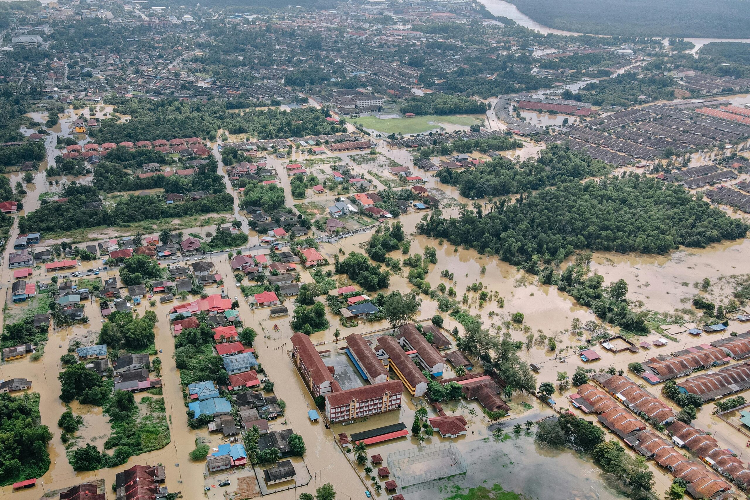
Traditional FEMA flood maps have served communities for decades, but they represent just one dimension of risk. Contemporary resilience mapping integrates climate projections, recognizing that historical patterns no longer reliably predict future conditions. This forward-looking approach accounts for changing precipitation patterns, sea-level rise, and temperature increases that alter traditional risk zones.
The difference matters significantly for property protection. A home that previously sat outside designated flood zones might face increased inundation risk within the next decade due to changing rainfall intensity. Resilience maps that incorporate climate modeling can reveal these evolving vulnerabilities before they manifest in costly damage.
💡 Why Clear Communication Makes All the Difference
The most sophisticated resilience data becomes worthless if homeowners cannot understand or access it effectively. Communication strategies must translate technical environmental science into practical guidance that motivates protective action without creating unnecessary alarm.
Effective resilience communication balances transparency about genuine risks with constructive pathways for mitigation. Homeowners need context that helps them interpret what “moderate flood risk” or “high wildfire susceptibility” actually means for their daily lives and long-term financial security.
Visual clarity represents a critical component. Color-coded maps with intuitive legends outperform dense technical reports. Interactive digital platforms that allow homeowners to zoom into their specific property, toggle different risk layers, and access customized recommendations dramatically increase engagement and comprehension.
Breaking Down Technical Jargon into Actionable Insights
Terms like “return period,” “base flood elevation,” and “liquefaction potential” confuse rather than clarify for most property owners. Successful communication reframes these concepts in relatable terms. Instead of discussing “500-year flood events,” effective messaging might explain “severe flooding that has a 0.2% chance of occurring in any given year.”
Providing context through comparison helps tremendously. Explaining that a specific risk level is comparable to common experiences—like the probability being similar to other familiar odds—creates mental anchors that facilitate understanding and appropriate response calibration.
🏠 Empowering Homeowners Through Knowledge and Action
Access to resilience mapping information fundamentally shifts the homeowner relationship with property risk from passive uncertainty to active management. This empowerment manifests across multiple dimensions of homeownership, from purchase decisions to ongoing maintenance priorities.
When buyers can review comprehensive resilience profiles before purchasing property, they enter transactions with realistic expectations about potential challenges and necessary protective investments. This transparency prevents the unfortunate scenario where new homeowners discover significant vulnerabilities only after closing, when financial flexibility has diminished.
For existing homeowners, resilience maps provide justification for protective upgrades that might otherwise seem optional. Understanding that your property sits in a high-risk wildfire zone transforms defensible space landscaping from aesthetic choice to critical investment that could prevent total loss.
Translating Maps into Concrete Protection Strategies
The connection between viewing a resilience map and implementing protective measures requires clear guidance. Effective communication includes specific recommendations tailored to identified risks:
- Flood-prone properties benefit from elevation certificates, sump pump installation, and flood-resistant building materials
- Wildfire-risk homes need ember-resistant vents, defensible space clearing, and fire-resistant roofing materials
- Earthquake-vulnerable structures should prioritize foundation bolting, water heater strapping, and flexible utility connections
- Hurricane-exposed properties require impact-resistant windows, roof reinforcement, and proper tree maintenance
- Properties facing multiple risks need integrated strategies that address compound vulnerabilities
📊 The Financial Case for Resilience Investment
Resilience mapping reveals not just physical vulnerabilities but significant financial implications. Property insurance premiums increasingly reflect granular risk assessments, with insurers using sophisticated modeling that parallels resilience mapping methodologies.
Homeowners who understand their specific risk profile can make strategic decisions about coverage levels, deductibles, and supplemental policies. In high-risk areas where traditional insurance becomes prohibitively expensive or unavailable, resilience maps help prioritize physical mitigation measures that might qualify for premium discounts or maintain insurability.
The property value implications extend beyond insurance costs. As climate awareness grows among buyers, resilience profiles increasingly influence market values. Homes with documented protective upgrades in vulnerable areas maintain value better than comparable properties without such improvements.
Calculating Return on Resilience Investments
Understanding the cost-benefit equation helps homeowners prioritize among competing financial demands. Resilience communication should include realistic investment ranges and potential savings:
| Protection Measure | Typical Investment | Potential Damage Prevented | Insurance Impact |
|---|---|---|---|
| Foundation Elevation | $15,000-$30,000 | $50,000-$150,000 | 30-50% premium reduction |
| Fire-Resistant Roofing | $8,000-$20,000 | $200,000-$500,000 | 10-25% premium reduction |
| Seismic Retrofitting | $5,000-$15,000 | $75,000-$200,000 | 5-15% premium reduction |
| Storm Shutters | $2,000-$8,000 | $20,000-$80,000 | 10-20% premium reduction |
These investments often prove worthwhile even without disaster occurrence, through insurance savings that accumulate over years and enhanced property marketability that preserves equity.
🌐 Digital Tools Making Resilience Information Accessible
Technology has democratized access to resilience information that previously required expensive consultants or specialized expertise. Various platforms now offer homeowners direct access to risk assessments customized for their specific addresses.
Federal agencies like FEMA provide publicly accessible flood mapping tools, while organizations like First Street Foundation have developed comprehensive climate risk databases covering flood, wildfire, heat, and wind exposures. State and local governments increasingly offer their own resilience portals tailored to regional hazards.
These digital tools typically allow address-specific searches that generate detailed risk reports. Many include temporal projections showing how risks might evolve over 15, 30, or even 50-year horizons—critical information for homeowners planning long-term occupancy or considering property as multi-generational wealth.
Maximizing Value from Available Resilience Resources
Navigating the landscape of available resilience tools requires some strategy. Homeowners benefit from consulting multiple sources, as different platforms emphasize different risk factors or use varying methodologies. Cross-referencing several tools provides a more complete picture than relying on any single assessment.
Documentation matters significantly. Saving reports, taking screenshots of maps, and maintaining records of resilience information creates valuable references for insurance discussions, property improvements, and potential future sales. This documentation also helps track how risk assessments change over time as new data and modeling improve.
🔧 Working with Professionals to Implement Resilience Strategies
While resilience maps provide essential information, translating that knowledge into effective physical improvements often requires professional expertise. Contractors, engineers, and resilience consultants can assess specific properties and recommend tailored solutions that maps alone cannot provide.
The key involves finding professionals familiar with climate-adapted construction techniques appropriate to your region’s specific threats. A contractor experienced with flood mitigation in coastal areas brings different expertise than one specializing in wildfire hardening in arid regions.
Many communities now offer resilience consultation programs through local governments or utility companies, sometimes subsidized to encourage protective upgrades. These programs can provide home assessments that complement broader resilience mapping with property-specific recommendations accounting for individual structural characteristics.
Questions to Ask Resilience Professionals
When engaging contractors or consultants for resilience improvements, homeowners should inquire about specific qualifications and approaches:
- What certifications or training do you have in climate-resilient construction techniques?
- Can you provide examples of similar projects addressing the specific risks identified for my property?
- How will these improvements potentially affect my insurance premiums or property value?
- What maintenance will these protective measures require over time?
- Are there grant programs or financing options available for these improvements?
- How do you prioritize among multiple potential improvements when budget is limited?
🌍 Community-Level Benefits of Widespread Resilience Mapping Adoption
Individual property protection creates positive externalities that benefit entire neighborhoods. When multiple homeowners in a community implement resilience strategies based on shared risk information, collective vulnerability decreases substantially.
This community effect proves particularly significant for risks like wildfire, where one unprotected property can endanger surrounding homes, or flooding, where neighborhood-scale drainage improvements outperform isolated efforts. Resilience communication that emphasizes these collective benefits can motivate coordinated action.
Municipal governments increasingly recognize that facilitating homeowner access to resilience information reduces community-wide disaster costs, infrastructure demands, and recovery burdens. Progressive jurisdictions now incorporate resilience mapping into permitting processes, zoning decisions, and capital improvement planning.
📱 Staying Current as Risk Landscapes Evolve
Resilience mapping represents a snapshot of current understanding, but risk landscapes continually evolve as climate patterns shift and scientific modeling improves. Homeowners benefit from periodically revisiting resilience resources to identify whether their property risk profile has changed.
Major updates to flood maps, wildfire severity zones, or seismic hazard assessments warrant renewed attention to whether existing protective measures remain adequate. Climate velocity—the pace at which conditions are changing—varies significantly by region, with some areas experiencing rapid risk evolution while others see more gradual shifts.
Establishing a practice of annual resilience reviews, perhaps tied to insurance renewal periods, helps ensure protective strategies remain aligned with current risk understanding. This ongoing attention transforms resilience from a one-time project into an integrated aspect of responsible homeownership.

🎯 Taking the First Step Toward Enhanced Property Protection
The journey toward comprehensive property resilience begins with simple information gathering. Homeowners can start by searching for their address on publicly available resilience mapping platforms to understand baseline vulnerabilities. This initial assessment requires no financial investment, just willingness to engage with potentially concerning information constructively.
From that foundation, prioritization becomes key. Not every identified risk requires immediate action, but understanding the full spectrum of potential challenges enables strategic planning. Homeowners might address the most severe or likely risks first while developing longer-term plans for secondary concerns.
The psychological dimension matters as well. Resilience knowledge can initially feel overwhelming, particularly when multiple significant risks appear on property assessments. Framing this information as empowering rather than alarming—as providing control rather than revealing helplessness—supports productive engagement rather than avoidance.
Connecting with neighbors who share similar risk profiles creates support networks for both information sharing and potential collective action. Community resilience groups increasingly form around shared challenges, pooling knowledge about effective contractors, successful grant applications, and lessons learned from implemented protective measures.
Property resilience represents an evolving field where homeowner awareness and engagement drive continuous improvement in both available tools and practical solutions. By understanding and utilizing resilience mapping resources, property owners transform from passive victims of climate uncertainty into active managers of their investment security and family safety.
The conversation around resilience continues expanding as more homeowners recognize that climate adaptation isn’t abstract environmental policy but concrete personal financial protection. Each property owner who engages with resilience information, implements protective improvements, and shares experiences with neighbors contributes to a broader cultural shift toward proactive climate adaptation.
This collective momentum matters because individual resilience efforts, multiplied across communities and regions, create the foundation for societal climate adaptation. The same maps that empower individual homeowners to protect specific properties also inform community planning, infrastructure investment, and policy development that enhances resilience at larger scales.
As resilience mapping tools continue improving in accuracy, accessibility, and usability, their potential to transform property ownership relationships with climate risk grows correspondingly. The homeowners who engage with these resources today position themselves advantageously for a future where climate-informed property management becomes standard practice rather than exceptional foresight.